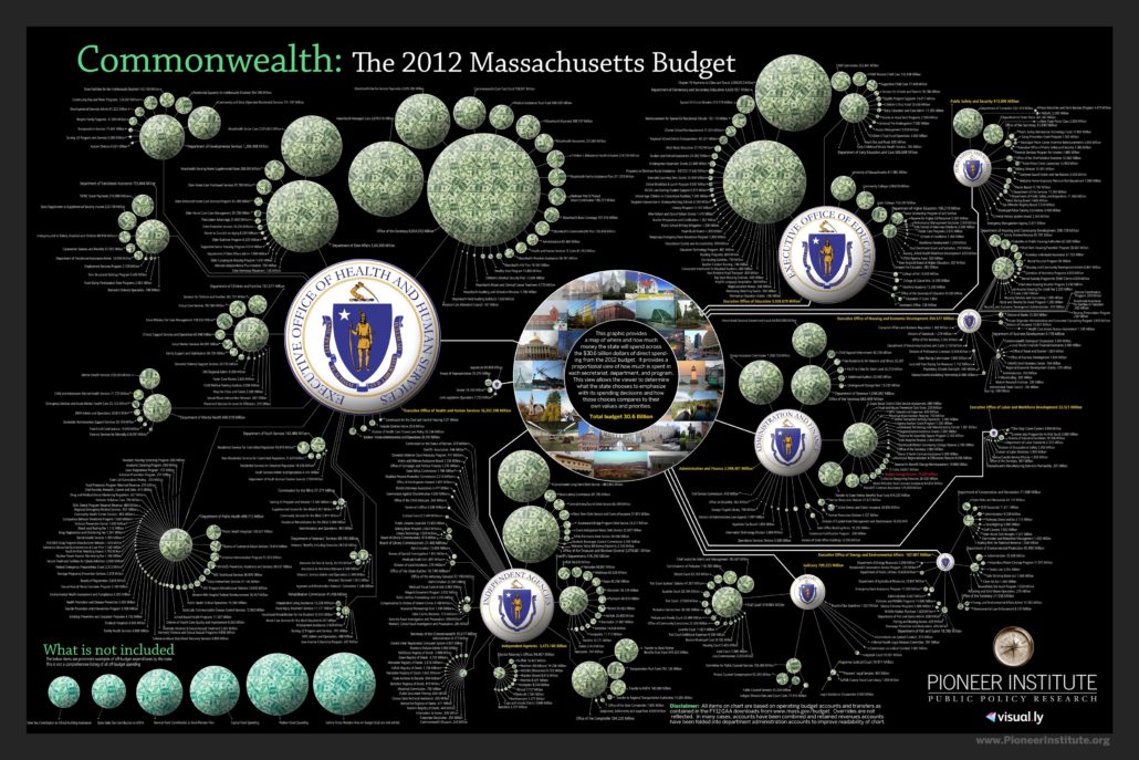
2012 Massachusetts State Spending Map
In 2012, Pioneer Institute proudly reprised this exciting online tool — a spending map of Massachusetts’ state government — designed to help bring about more openness and accountability.
The map presents hundreds of government departments, agencies, and programs in a visual format, proportionate in size to their funding level. Looking at the whole map, viewers can ascertain the state’s spending priorities. You will also be able to scroll over and zoom into each component for a more in-depth examination of the number of agencies and departments that exist, and easily identify bureaucracy, inefficiency, and unnecessary duplication.
Pioneer is pleased to provide this useful online map in an adjustable display format for all Massachusetts citizens interested in obtaining information about your government in a manner that is speedy, user-friendly, and free.
